
Satellite Imagery Services
Advanced Agricultural Mapping and Analysis
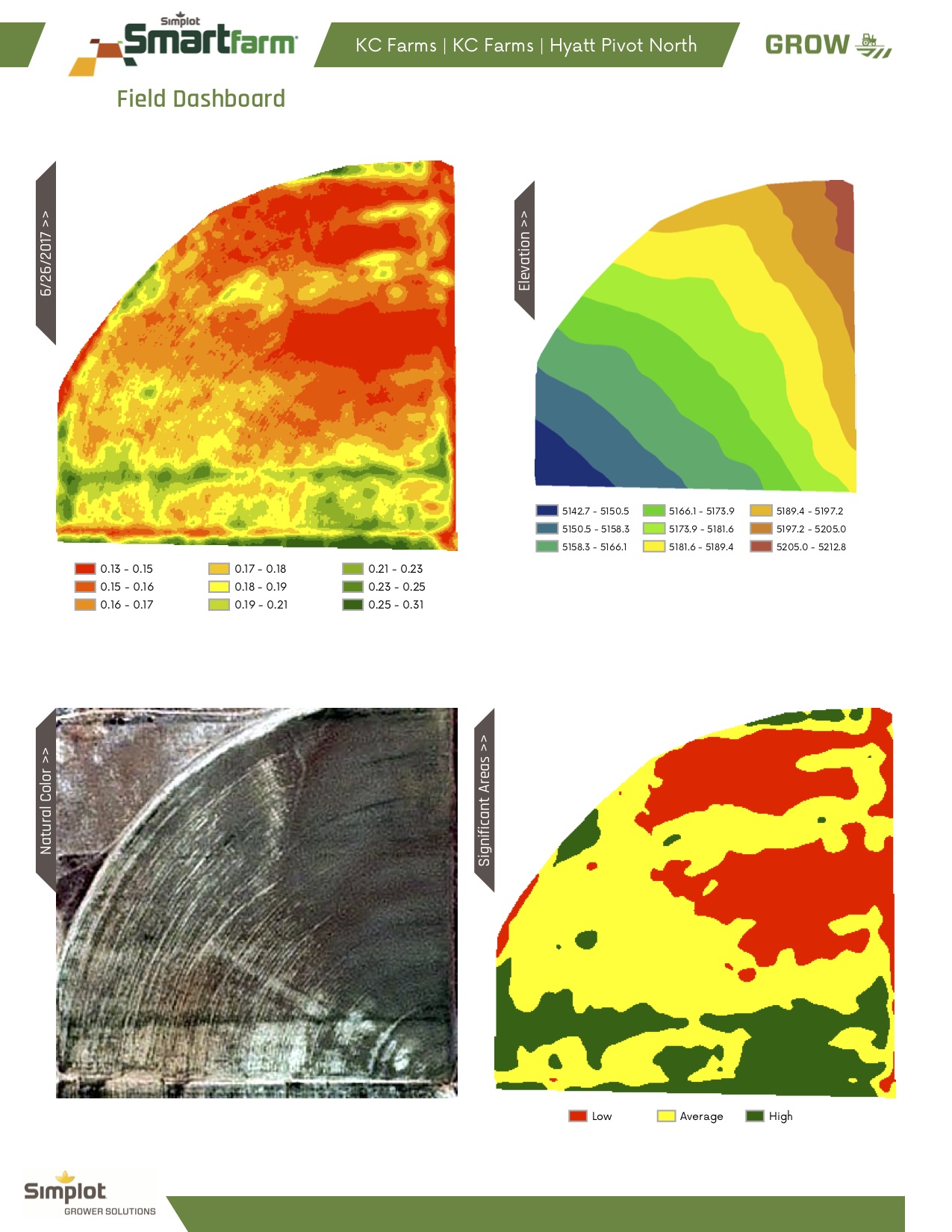
Crop Health Satellite Imagery
Our satellite imagery service identifies weak spots in crop photosynthesis, helping you locate and address problem areas in your fields.
Weekly Reporting
- Crop Health Map Generation
- Weak Acres Percentage Report
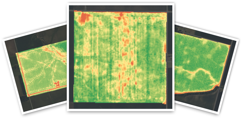
Sample Reports
Customized Farming Solutions
Each field is unique. Through our comprehensive approach combining satellite imagery, soil testing, and crop tissue testing, we can help you:
- Create perfect fertilizer mixes
- Find the right pesticides
- Achieve maximum crop health
- Optimize crop yield
Understanding Your Heat Map
Our weekly reports use color-coding to highlight field performance:
- Green Areas: Highest producing parts of the field
- Red Areas: Lowest producing parts of the field
This visualization helps discover areas with potential issues like pest infestations or nutrient deficiencies.